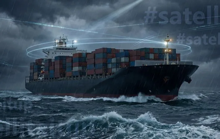
The Global Maritime Distress and Safety System (GMDSS) was established in 1988 by the International Maritime Organisation (IMO). It outlines the mandatory communications equipment for vessels, their maintenance, government regulations and supporting infrastructure at shore-based facilities, and the conditions for their usage.
GMDSS improves the capability of ships to state their distress requirements, receive assistance, and broadcast essential safety-related information automatically. IMO has clearly defined four operational zones – based on distance from the shore – for the effective implementation of GMDSS:
A1 – coverage of at least one VHF coast station with DSC alerts
A2 – coverage of at least one MF coast station with DSC alerts
A3 – coverage of an approved satellite constellation with continuous alerts (at present); coverage of a recognised mobile satellite service with continuous alerts (2024 onwards)
A4 – coverage beyond A1, A2, A3
Advances in Satellite Technology
With satellite communications technology, GMDSS continues to become more efficient and streamlined. Today, Inmarsat and Iridium are recognised as certified providers for GMDSS.
Inmarsat C is the only compliant service in A1 – A4 areas. It has been keeping seafarers safe at sea since its inception in 1999. Iridium GMDSS gained approval from IMO and SOLAS in 2020 and is currently compliant with SOLAS for A1 – A3.
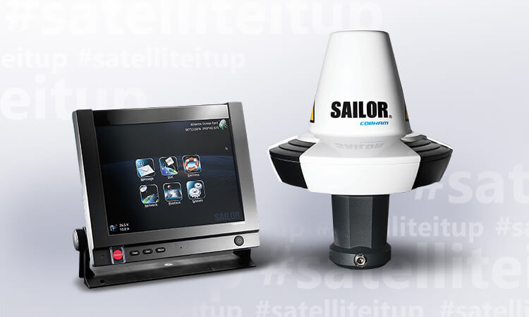
Inmarsat’s Sailor 6110 GMDSS System
A next generation GMDSS solution, SAILOR 6110 GMDSS System safely handles all GMDSS, SSAS, and LRIT operations onboard. It features the world’s first touchscreen Wheelmarked GMDSS terminal and includes both visual and audio alarm functionality. The innovative cabling reduces maintenance time and costs while optimising routing. Reliable and adaptable, SAILOR 6110 GMDSS System includes VHF as well as MF/HF distress functionality. SAILOR 6110 GMDSS System is an integral aspect of the vessel communications system that meets international maritime standards.
Key Features:
First-ever approved touchscreen terminal for GMDSS use
External storage via SD card or USB disk
Accurate, reliable 50-channel GPS module that is also Galileo ready
ThraneLINK
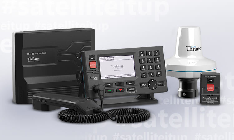
Iridium’s LT-3100S GMDSS System
Especially designed for the demanding and rough environment at sea, LT-3100S GMDSS System by Lars Thrane is the first terminal that offers 100% global GMDSS coverage on the Iridium® satellite network. LT-3100S is equipped with GMDSS services such as Distress Alert, Safety Voice, and Maritime Safety Information (MSI) and operates between a broad temperature range of -40°C to +55°C. LT-3100S can be used as the primary communications product onboard all IMO vessels.
Key Features:
Distress Alert activated by the press of a button
Maritime Safety Information (MSI) transmitted through an Enhanced Group Call (EGC) service called Iridium SafetyCastSM: Navigational, Meteorological, Safety-Related
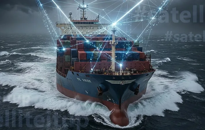
IEC Telecom is committed to empowering vessel owners with integrated and scalable communication services that ensure improved safety for the crew.
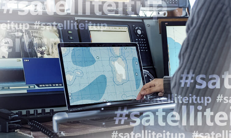
In addition to the GMDSS, IEC Telecom’s safety package includes a bespoke tracking system, enabling advanced visibility over the vessel’s navigation and performance.
Developed by Traksat, a specialised IoT & M2M unit within IEC Telecom, the tracking platform supports a wide range of requirements, including:
ADVANCED MAPPING
Various mapping layers with specific nautical charts on-demand such as Navionics
Addition of mapping layers from the library or integration of any WMS and ESRi ArcGis feed
Weather overlay
Customised mapping
GEOFENCING
EEZ AREAS: illegal fishing activity outside of authorised areas is easily detected, reported, and stored for future replay/reports
NO FISHING ZONES: pre-defined polygon, triggering special events upon vessel entry/exit
ALARMS & EVENT NOTIFICATIONS
FRAUD DETECTION: possibility to create dynamic geofencing with a specific radius around two or more vessels and trigger an alert when they are within this radius
TIME-OUT ALERTS: possible to define a time threshold for reporting, where an alert will be triggered automatically if data is not received within the set time frame
ASSET CONFIGURATION
Possibility to define many other parameters, such as week and weekend regular work hours, temperature sensor alerts, speed alerts, idling alerts, etc.
MESSAGING
Possibility to send a text message or email from the web platform to a specific user or group of users, who can respond to the messages received from the platform via text or email
In order to protect your privacy, we would like to herewith inform you that IEC Telecom uses cookies to track the performance of your session.
By clicking on the“Accept” button, you agree to the storing of cookies on your device to enhance your website experience.