




Humanitarian tracking solutions for NGOs have become a critical operational requirement as aid organisations operate in increasingly complex and high-risk environments. NGOs deliver essential services such as shelter, food, medical care, and education across regions affected by natural disasters, conflict, and climate-related displacement.
Over the past two decades, humanitarian needs have grown significantly in both scale and complexity. According to UN estimates, the number of people requiring humanitarian assistance worldwide has increased from approximately 70-80 million in the early 2000s to more than 300 million today. As operations expand into remote and unstable regions, ensuring staff safety and operational visibility has become a growing priority.
At the same time, NGO field teams face rising security risks, including:
- Armed conflict and civil unrest
- Criminal activity
- Environmental and climate-related hazards
Dedicated Safety and Security Teams monitor these risks and advise humanitarian managers on how to deploy personnel safely. However, security conditions can change rapidly and with little warning, making real-time visibility and reliable communication essential.
Technology now plays a central role in enabling humanitarian tracking solutions for NGOs. While traditional tools such as VHF radios and mobile phones remain widely used, they can become unreliable when:
- Infrastructure is damaged
- Mobile networks fail
- Access is restricted during crises
Combined with ongoing funding constraints and reduced staffing levels, NGOs increasingly rely on automated tracking systems to maintain situational awareness and protect field teams.
TRAKSAT PLATFORM
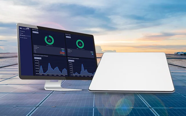
Real-time tracking for individuals, fixed and mobile assets
- Configurable geofences and points of interest
- Alerts for timely operational response
- Advanced reporting with historical and live data
- Supports multiple mapping and GIS platforms
- Effective management with user grouping and role-based access
- SOS and multi-channel alerts
Why Humanitarian Tracking Solutions for NGOs Are Needed
In an operational landscape shaped by rising security risks, expanding humanitarian needs, and tighter budgets, humanitarian tracking solutions for NGOs help maintain staff safety while reducing operational burden.
Modern tracking solutions allow NGOs to:
- Monitor the real-time location of personnel, vehicles, and assets
- Automatically generate alerts when teams enter high-risk areas
- Reduce reliance on manual monitoring by security staff
By automating routine tracking tasks, safety and security teams can focus on threat assessment and decision-making rather than constant supervision.
Who Should Use Humanitarian Tracking Solutions?
These solutions are designed for:
- International and local NGOs operating in conflict or disaster-prone regions
- Humanitarian organisations deploying staff to remote areas with limited connectivity
- Safety and security teams responsible for duty-of-care compliance
- NGOs managing mixed fleets of personnel, vehicles, and field assets
Core Components of a Humanitarian Tracking Solution
A humanitarian tracking solution typically consists of two core components.
-
Tracking Devices
Tracking devices are carried by field staff or installed in vehicles and assets. Devices such as the Garmin inReach range include built-in GPS and satellite connectivity, enabling reliable location reporting even in areas without mobile coverage. In addition to tracking, these devices support two-way satellite messaging, providing a dependable communication channel during emergencies or network outages.
-
Monitoring Platform
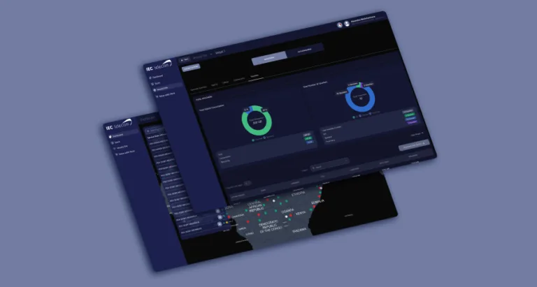
The monitoring platform is the operational backbone of humanitarian tracking solutions for NGOs. Platforms such as Traksat allow safety and security teams to visualise movements, manage alerts, and communicate with deployed users from a single interface.
Security managers can configure geofences, receive automated alerts when predefined boundaries are crossed, and update risk zones dynamically as security conditions evolve. Integrated messaging tools allow urgent instructions, such as areas to avoid or orders to return to base, to be sent instantly to individuals or groups.
GARMIN INREACH®
with Traksat Software
- Location tracking with customisable reporting intervals
- Two-way messaging with platform and personal contacts
- Interactive SOS with configurable alert routing
- Remote management with no credit card required
- Interoperable with other devices on the Traksat platform
Why Garmin Is Widely Used in the NGO Sector
Since releasing its first GPS-based product in 1990, Garmi
n has grown into a global leader in navigation and positioning technologies. Over the past 35 years, the company has expanded its portfolio from high-precision surveying equipment to consumer and professional solutions used worldwide.
Garmin devices integrate multiple global navigation satellite systems, including GPS, GLONASS, Galileo, and BeiDou, and pair this capability with Iridium satellite communication through the inReach product line. This combination enables truly global tracking and messaging coverage.
Because Garmin manufactures at scale for the retail market, its devices are widely available, durable, and produced to high reliability standards. Humanitarian organisations can often source Garmin equipment locally, which simplifies procurement and deployment.
Garmin also offers its own consumer-oriented tracking interface, MapShare. Designed for recreational users, MapShare enables basic location sharing, messaging, and SOS routing to public emergency services. While effective for personal outdoor activities, it lacks the operational control, scalability, and governance required for humanitarian missions which means that organisations can sign up to Garmin InReach Professional or a third-party solution like Traksat
What Makes Traksat Different from Garmin inReach Professional
Garmin inReach Professional is well suited to organisations that deploy remote teams , but humanitarian operations sometimes require a more agnostic solution.
Traksat is fully compatible with all Garmin inReach devices and can also monitor a wider range of technologies, including mobile phones, selected satellite phones, and other tracking systems. This enables organisations to manage mixed-technology fleets through a single operational interface.
In regions where public emergency services are limited or unavailable, Traksat allows SOS alerts to be routed directly to:
- Internal response teams for faster decision-making
- Partner organisations supporting joint operations
- Private security providers where public emergency services are inaccessible
This ensures appropriate escalation pathways without relying solely on external responders.
Traksat also offers institutional billing flexibility. Credit-card payments are not required, and services can be consolidated alongside other connectivity solutions, reducing administrative and financial complexity for humanitarian organisations operating at scale.
Key Benefits of Combining Garmin and Traksat
- Global satellite coverage without reliance on local infrastructure
- Centralised monitoring across teams and regions
- Automated alerts that reduce manual oversight
- Flexible emergency escalation tailored to humanitarian contexts
- Scalable deployment across mixed technology environments
A side-by-side comparison table follows here to highlight the differences between consumer-oriented and operational tracking platforms.
| Feature | Garmin inReach Professional | Traksat |
|---|---|---|
| Satellite positioning & navigation | Built into Garmin inReach devices | Uses the same device capability |
| Two-way satellite messaging & SOS | Available on inReach devices. SOS messages are managed by Garmin’s own response centre | SOS messages can be managed by any resource designated by the client organisation. |
| Tracking interface | Simple web sharing tracking website portal. Multiple devices supported | Centralised operational platform |
| Monitoring multiple users | Professional plans support multiple devices on one account | Supports multi-user monitoring |
| Geofencing & boundary alerts | Not supported | Custom zones with automated alerts |
| Reporting & mission logs | Basic trip history | Centralised reporting and analytics |
| Team and group management | Basic group management features | Teams and sub-teams supported with group messaging. |
| Tracking interval control | Intervals from 2 minutes supported. 30 second tracking available upon request | Fully configurable from 30 seconds. Intervals can automatically change to longer intervals when the tracker is static. |
| Licence and device management | Not available | Centralised management |
| Technologies supported | Garmin inReach only | Multiple tracking technologies |
| Alerting and automation | Location display only | Rule-based alerts |
| Mapping and GIS options | Various standard map options available | Organisation can implement any third-party mapping solution such as ESRI. |
| User access control | Account admin, group admin, billing admin and device users have own access to website | Role-based permissions |
| Patrol or mission checklists | Not available | Supported |
| Dynamic geofencing | Not available | Supported |
| IoT and sensor data | Not available | Supported |
| Billing model | Credit card–based, direct debit, Enterprise billing and Paypal | Enterprise billing, post-paid, customised bill formats |
Garmin inReach Professional
Built into Garmin inReach devices
Traksat
Uses the same device capability
Garmin inReach Professional
Available on inReach devices. SOS messages are managed by Garmin’s own response centre
Traksat
SOS messages can be managed by any resource designated by the client organisation.
Garmin inReach Professional
Simple web sharing tracking website portal. Multiple devices supported
Traksat
Centralised operational platform
Garmin inReach Professional
Professional plans support multiple devices on one account
Traksat
Supports multi-user monitoring
Garmin inReach Professional
Not supported
Traksat
Custom zones with automated alerts
Garmin inReach Professional
Basic trip history
Traksat
Centralised reporting and analytics
Garmin inReach Professional
Basic group management features
Traksat
Teams and sub-teams supported with group messaging.
Garmin inReach Professional
Intervals from 2 minutes supported. 30 second tracking available upon request
Traksat
Fully configurable from 30 seconds. Intervals can automatically change to longer intervals when the tracker is static.
Garmin inReach Professional
Not available
Traksat
Centralised management
Garmin inReach Professional
Garmin inReach only
Traksat
Multiple tracking technologies
Garmin inReach Professional
Location display only
Traksat
Rule-based alerts
Garmin inReach Professional
Various standard map options available
Traksat
Organisation can implement any third-party mapping solution such as ESRI.
Garmin inReach Professional
Account admin, group admin, billing admin and device users have own access to website
Traksat
Role-based permissions
Garmin inReach Professional
Not available
Traksat
Supported
Garmin inReach Professional
Not available
Traksat
Supported
Garmin inReach Professional
Not available
Traksat
Supported
Garmin inReach Professional
Credit card–based, direct debit, Enterprise billing and Paypal
Traksat
Enterprise billing, post-paid, customised bill formats
The Garmin Hardware Range
Garmin offers a broad range of inReach devices suited to different operational profiles. Larger devices with integrated mapping support navigation-heavy missions, while compact models such as the inReach Mini are discreet and well suited to high-risk environments where low visibility is important.
All inReach models support basic messaging and SOS functions. For extended messaging, Garmin’s Messenger and Explore apps connect via Bluetooth on iOS and Android devices and are compatible with Traksat. However, deploying these consumer apps at scale can be challenging, as registration often requires SMS verification and local mobile numbers.
To address this, Traksat is launching a dedicated mobile application in mid-2026, building on the existing Traklink platform and adding satellite connectivity to simplify deployment and improve reliability for institutional users.
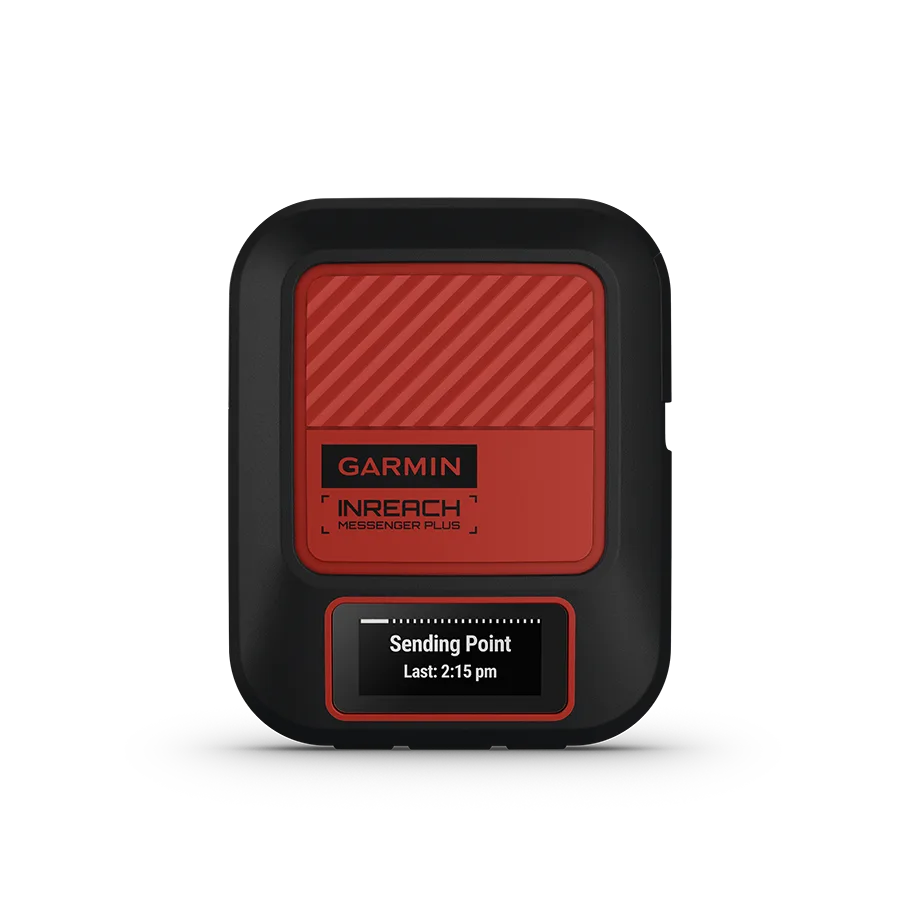
inReach Messenger Plus
SOS satellite communicator with photo and voice messaging.
- Unit size: 7.8 x 6.4 x 2.3 cm
- Screen size: 2.53 x 1.1 cm 2.74 cm diagonal
- Water rating IPX7
- Max battery life of 600 hours (low power mode with location being sent every 10 mins)
- GNSS: GPS, Galileo, QZSS, Beidou
- SOS & messaging features via phone app connected via Bluetooth
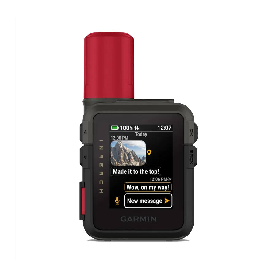
inReach Mini 3
- Unit size: 5.50 x 9.80 x 2.67 cm
- Screen size: 38.56 x 28.98 mm, 48.26 mm diagonal
- Water rating IP67
- Max battery life of 350 hours (low power mode with location being sent every 10 mins)
- GNSS: GPS, Galileo, QZSS, Beidou
- Base map & Waypoints
- Interactive SOS
- Send and receive photo and voice messages from device
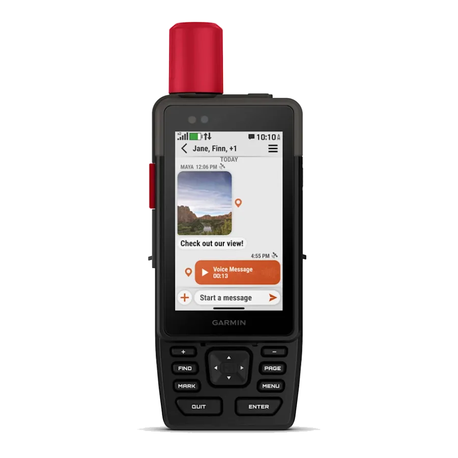
GPSMAP H1/H1i Plus | Premium handheld GPS navigator
- Unit size: 6.7 cm x 17.9 cm x 3.3cm
- Screen size: 4.7 x 7.7 cm, 8.9 cm diagonal
- Water rating IP67
- Max battery life of 840 hours in expedition mode
- GNSS: GPS, Galileo, QZSS, Beidou, IRNSS
- Pre-loaded maps and the ability to add more.
- Interactive SOS
- Send and receive photo and voice messages from the device
Traksat Platform Capabilities
The Traksat platform supports monitoring across the full range of Garmin inReach devices, as well as satellite phones, digital VHF systems, and other compatible technologies. Its technology-agnostic design allows security teams to oversee multiple tracking solutions through a single interface.
Many organisations already own Traksat-compatible equipment, enabling rapid deployment without significant additional investment. Direct, secure connections to satellite networks ensure that location data and personal information are protected and do not pass through public networks.
Key capabilities include:
-
Real-Time Visibility
Live tracking of personnel, vehicles, and assets supports proactive safety management in remote and high-risk locations.
-
Geofencing and Safety Controls
Automated alerts notify teams when predefined boundaries are crossed, helping organisations prevent exposure to known risks.
-
Two-Way Messaging
Security teams can communicate directly with field users, enabling check-ins, instructions, and situational updates.
-
SOS and Emergency Escalation
SOS alerts can be routed to internal responders or designated partners, ensuring appropriate response pathways in areas without public emergency services.
-
Data-Driven Insights
Reporting and analytics tools support mission review, resource optimisation, and compliance with operational standards.


What Does Tracking Look Like in 2026?
Demand for tracking solutions within the humanitarian sector continues to grow and is expected to increase further in 2026. Garmin is likely to remain a preferred hardware provider due to its reliability, competitive pricing, and global availability.
Garmin has recently introduced the inReach Mini 3, offering extended battery life and the ability to send photos via satellite, an important enhancement for situational awareness.
On the software side, Traksat’s dedicated mobile app, launching mid-2026, will address the deployment limitations of consumer apps and provide a streamlined, purpose-built experience for humanitarian organisations.
Summary: Garmin and Traksat for Humanitarian Operations
Garmin inReach devices provide reliable satellite tracking and messaging at the field level, while Traksat transforms this data into a centralised, operational tracking solution designed specifically for NGOs. Together, they enable safer deployments, faster incident response, and reduced operational burden in complex humanitarian environments.


Build the Right Connectivity Solution
Tell us where you operate and what you need to connect. Our experts will help identify the right solution for your operations.