



The Global Maritime Distress and Safety System (GMDSS) is the internationally mandated network of satellite and radio equipment, procedures and protocols that ensures a ship in distress can automatically alert rescue authorities and nearby vessels anywhere in the world. It is required under SOLAS Chapter IV for all cargo ships of 300 gross tonnage and above, and all passenger ships, on international voyages.
The Global Maritime Distress and Safety System (GMDSS) was established in 1988 by the International Maritime Organisation (IMO). It outlines the mandatory communications equipment for vessels, their maintenance, government regulations and supporting infrastructure at shore-based facilities, and the conditions for their usage.
GMDSS improves the capability of ships to state their distress requirements, receive assistance, and broadcast essential safety-related information automatically. It replaced Morse-code distress signalling with an automated framework of satellite and terrestrial radio systems, operating on frequencies coordinated by the International Telecommunication Union – fully implemented across the global fleet by 1999. For its effective implementation, the IMO has clearly defined four operational zones based on distance from the shore, each carrying its own minimum equipment requirements.
Why GMDSS Still Matters in Modern Maritime Communications
GMDSS remains mandatory and relevant because it operates independently of commercial bandwidth and functions without degradation in severe weather. Modern satellite networks like Starlink and VSAT carry a vessel’s daily operational data, but GMDSS was built for survival when all else fails, independent of business bandwidth or crew traffic.
Far from obsolete, GMDSS continuously evolves alongside satellite technology. Following its major 2024 update, the framework remains the indispensable, legally mandated safety layer that guarantees a vessel can always transmit a distress call, no matter how high-tech the rest of the ship becomes.
How GMDSS Works
GMDSS is built around six core functions, and understanding them explains why the system is structured the way it is.
- Distress alerting, with automatic position reporting, so rescue authorities know both that a vessel is in distress and exactly where it is.
- Search and rescue coordination, linking the vessel to shore-based rescue authorities and nearby ships.
- Maritime Safety Information (MSI) broadcasts, covering navigational warnings, weather forecasts and other safety-critical updates.
- Locating and homing, helping rescue units find survival craft or a vessel in distress.
- General radiocommunications, for routine operational and administrative traffic.
- Bridge-to-bridge communications, supporting collision avoidance between vessels in close proximity.
No single piece of equipment performs all six. Instead, GMDSS combines several technologies, each responsible for a specific function, into one coordinated system.
The Elements of GMDSS
The building blocks of a GMDSS installation include:
- VHF and MF/HF radio with Digital Selective Calling (DSC), for short and medium-range distress alerting and voice communication
- Satellite terminals operating on a Recognised Mobile Satellite Service (Inmarsat or Iridium), for distress alerting and safety communication beyond radio range
- EPIRBs (Emergency Position Indicating Radio Beacons), 406 MHz satellite beacons that transmit a vessel’s position automatically when activated
- SART and AIS-SART (Search and Rescue Transponders), which help rescue units locate survival craft
- NAVTEX and Enhanced Group Call (EGC) receivers, which deliver Maritime Safety Information automatically, without requiring a crew member to be listening
Each element maps to one or more of the six core functions above. Which of them a vessel must carry, and to what specification, depends entirely on where it operates.
Sea Areas and Minimum Equipment Requirements
GMDSS carriage requirements scale with distance from shore and the type of coverage available. The IMO defines four sea areas, and the equipment a vessel must carry increases with each one.
Sea Area A1: A1 covers waters within reach of a shore-based VHF coast station broadcasting Digital Selective Calling (DSC), commonly cited as extending 20 to 30 nautical miles from the coast, though the true edge is defined by actual VHF DSC coverage rather than a fixed distance. Vessels here rely primarily on VHF radio with DSC for distress alerting, supported by NAVTEX, a satellite EPIRB, and SART or AIS-SART for locating survival craft during a rescue.
Sea Area A2: A2 extends beyond A1, within range of a shore-based MF coast station equipped with DSC, commonly cited as reaching up to 100 to 150 nautical miles from shore. MF radio with DSC becomes the primary means of raising a distress alert, carried in addition to every A1 requirement. Vessels running routes that regularly move beyond VHF range but stay within coastal shipping lanes typically fall into this category.
Sea Area A3: A3 covers ocean waters within geostationary satellite coverage, roughly between 70°S and 70°N, accounting for most of the world’s open shipping routes. Vessels here must carry a certified Recognised Mobile Satellite Service (RMSS) terminal, Inmarsat or Iridium, on top of all A1 and A2 equipment. Since the 2024 amendments, a vessel’s Safety Radio Certificate must name the specific RMSS provider fitted, making the choice of network a compliance decision as much as an operational one.
Sea Area A4: A4 covers the polar regions beyond geostationary satellite reach, above roughly 70°N and below 70°S, historically unserved by Inmarsat coverage. Vessels here need a full MF/HF installation with DSC, a satellite EPIRB, and communications capable of functioning at high latitudes. Iridium’s pole-to-pole coverage has made compliant A4 operation more practical for vessels such as Nordic fishing fleets and polar research vessels than it was under the Inmarsat-only regime.
GMDSS Compliance & the 2024 Mandate Update
GMDSS is not a patchwork of national systems but a single regulatory framework established by the IMO under SOLAS Chapter IV, with the same fundamental requirements across all 167 contracting states, representing approximately 99% of the world’s tonnage. GMDSS carriage is mandatory for all cargo ships of 300 gross tonnage and above operating on international voyages, as well as all passenger ships on international voyages, regardless of size.
However, practical implementation details, such as flag-state acceptance of a particular recognised mobile satellite service (RMSS) provider and national requirements for non-SOLAS vessels, including fishing fleets, may vary by flag and jurisdiction, making it essential to confirm the specific rules applicable to each vessel.
The 2024 Mandate Update
On 1 January 2024, the largest set of amendments to SOLAS Chapter IV since GMDSS was first implemented came into force. Three changes stand out for fleet owners.
Inmarsat and Iridium Both Recognised
Every explicit reference to “Inmarsat” is replaced with the generic term Recognised Mobile Satellite Service (RMSS). Inmarsat served as the original GMDSS satellite network for decades; Iridium was formally recognised by the IMO as an additional provider in 2020. The updated regulatory text makes this multi-provider ecosystem permanent.
Older Equipment Types Retired
Narrow Band Direct Printing, once a mandatory GMDSS function, is no longer required. Sea Area A1 now requires a satellite EPIRB rather than the VHF-EPIRBs previously accepted.
Certification Is Provider-Specific
Vessels operating in Sea Area A3 must now name the specific RMSS provider, Inmarsat and/or Iridium, on their Safety Radio Certificate. Installing Iridium in place of Inmarsat remains subject to each flag state’s own acceptance policy.
The Inmarsat & Iridium GMDSS Systems
With advances in satellite communications technology, GMDSS continues to become more efficient and streamlined. Today, two networks are recognised as certified providers for GMDSS, and since the 2024 amendments, the provider fitted must be named on your vessel’s Safety Radio Certificate. Here’s what each system brings to the bridge.
Inmarsat GMDSS
Inmarsat is the original GMDSS satellite network, it has been keeping seafarers safe at sea since the system became fully mandatory in 1999. Operating a constellation of geostationary satellites positioned high above the equator, Inmarsat provides continuous, reliable safety coverage across the waters where most of the world’s trade moves.
That long service history brings practical advantages: established acceptance across flag administrations, a mature ecosystem of certified terminals such as the SAILOR range, and shore infrastructure that Rescue Coordination Centres have worked with for a generation. Distress alerting, safety voice and Maritime Safety Information broadcasts are delivered through Inmarsat’s Enhanced Group Call service.
Iridium GMDSS
Iridium gained approval from the IMO and SOLAS as an additional GMDSS provider in 2020 – the first new network admitted since the system was created. Its low-earth-orbit constellation blankets the entire planet, pole to pole, bringing certified GMDSS coverage to the Sea Area A4 polar regions that geostationary networks have never been able to reach.
For vessels working high latitudes, Nordic fishing fleets, polar research vessels, Arctic supply routes, that changes what compliant operation looks like. Iridium GMDSS delivers Distress Alert at the press of a button, a Safety Voice line direct to a Rescue Coordination Centre, and Maritime Safety Information through the Iridium SafetyCast EGC service, covering navigational, meteorological and safety-related broadcasts.
One note for fleet owners: flag-state acceptance of Iridium equipment is granted flag by flag, so approval should be confirmed under your vessel’s specific flag before specifying equipment.
GMDSS Hardware at IEC Telecom
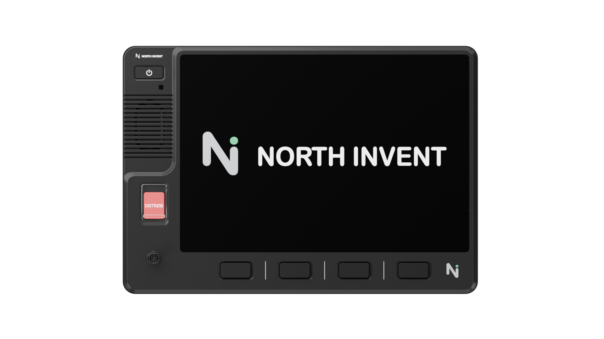
Thales WaveLink
A next-generation GMDSS solution that integrates advanced onboard safety features with versatile applications for industry-specific maritime operations, reimagining the GMDSS terminal as more than an emergency lifeline.
- Full GMDSS functionality: distress alerting, safety voice and MSI, plus LRIT and SSAS
- 10.1″ multi-touch panel computer with OpenBridge front-end interface for intuitive operation
- Seamless upgrade path – adding a WaveLINK panel transforms an existing Thales VesseLINK into a fully GMDSS-certified terminal without additional satellite hardware
- Hosts third-party applications such as fish-catch reporting and search-and-rescue coordination
- Truly global coverage via the Iridium Certus network

Intellian C700 GMDSS System
The only GMDSS system designed to leverage the Iridium Certus 700 service, one terminal that handles everything from daily communications to distress calls, with the higher throughput larger fleets need.
- Iridium GMDSS (Distress Alert, Safety Voice, MSI) plus LRIT and SSAS in a single terminal
- Dependable L-band connectivity for business data and voice alongside safety functions
- 100% global coverage including polar regions; meets IEC 61097-16 (2019) and MED/Wheelmark approved
- Serves as a robust companion link to flat panels or VSAT
- Safety Display Terminal gives the bridge direct, clear access to essential GMDSS functions; single coax cable between antenna and below-deck unit
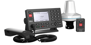
Lars Thrane LT-3100S GMDSS
Especially designed for the demanding and rough environment at sea, the LT-3100S is the first terminal to offer 100% global GMDSS coverage on the Iridium satellite network, and can be used as the primary communications product onboard all IMO vessels.
- Distress Alert activated by the press of a button
- Maritime Safety Information via the Iridium SafetyCast EGC service: navigational, meteorological and safety-related broadcasts
- Safety Voice line to connect directly to a Rescue Coordination Centre
- Shore-to-ship distress calling and maritime assistance
- Operates across a broad temperature range of −40°C to +55°C
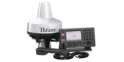
Lars Thrane LT-4200S
Powered by Iridium Certus 200, the LT-4200S meets all certification requirements for onboard GMDSS equipment (IMO MED & Wheelmark + SSAS/LRIT). It adapts easily as the primary communications product onboard small vessels, and delivers a stable back-up link for larger ones.
- Three high-quality voice channels and IP data speeds of up to 176 kbps
- 100% global coverage, compliant with the IEC 61097-16 (2019) GMDSS standard
- SSAS and LRIT integrated into one certified terminal
- Single-cable solution — the antenna can be mounted up to 150 m from the control unit
- Built-in webserver and large 4.3″ TFT display in a resilient, compact design
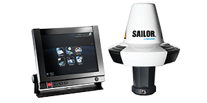
SAILOR 6110 GMDSS System
A next-generation GMDSS solution that safely handles all GMDSS, SSAS and LRIT operations onboard, with integrated VHF as well as MF/HF distress functionality. Reliable and adaptable, it’s an integral part of a vessel communications system that meets international maritime standards.
- First-ever approved touchscreen terminal for GMDSS use, with visual and audio alarm functionality
- Integrated VHF and MF/HF distress capability
- Accurate, reliable 50-channel GPS module that is also Galileo ready
- External storage via SD card or USB disk, plus ThraneLINK connectivity
- Innovative cabling that reduces maintenance time and costs while optimising routing
Installation and Support
Buying certified hardware is only part of staying compliant. GMDSS carriage rules also require:
- Flag-state type approval for the specific equipment fitted, confirming it meets the certification standard that flag has adopted
- Regular testing and logbook records, including daily equipment checks and periodic radio surveys as part of a vessel’s Safety Radio Certificate renewal
- A recognised method of maintaining equipment availability at sea, which SOLAS allows through any of three approaches: an onboard officer qualified to carry out at-sea maintenance, equipment duplication, or a shore-based maintenance agreement with a certified provider
Shore-based maintenance is the most common route for maritime companies who don’t want to carry a dedicated radio officer, and it’s where a managed provider adds the most practical value: coordinating installation, keeping documentation current for survey, and providing 24/7 technical support so a fault at sea doesn’t become a compliance gap. At IEC Telecom, we support fleet owners across this full lifecycle, from initial equipment selection and flag-state coordination through to global logistics and ongoing remote support.
Who Needs GMDSS?
Beyond mandatory carriage requirements, GMDSS is relevant to passenger vessels, commercial shipping fleets, fishing vessels, offshore operations and other vessels operating in remote or high-risk waters. The required level of coverage and equipment varies by vessel type, operating area and safety needs.

Commercial shipping: Tankers, container ships and bulk carriers over 300 GT carry GMDSS as a non-negotiable condition of international trading.

Offshore energy: Offshore support vessels, crew transfer vessels and floating platforms operate in some of the most remote and safety-critical environments at sea, where reliable distress alerting is inseparable from day-to-day risk management.

Commercial fishing: Fishing fleets operating far offshore in demanding conditions, such as the Norwegian Sea or Barents Sea, increasingly treat GMDSS-standard equipment as essential regardless of vessel size.

Passenger and cruise operations: Every SOLAS-certified passenger vessel carries GMDSS regardless of size, reflecting the scale of life-safety risk on board.

Government and humanitarian operations: Coast guard, search-and-rescue and humanitarian vessels frequently adopt GMDSS-standard equipment for interoperability with the same rescue authorities that commercial vessels rely on.
The Road Ahead: Future-Proofing Your Fleet’s GMDSS Strategy
GMDSS has changed more in the past two years than in the previous twenty. Iridium’s recognition alongside Inmarsat, and the retirement of older equipment types, have turned a fixed, single-operator system into a genuine choice between certified networks, one that comes with more compliance detail to manage, not less.
The task for fleet owners stays the same: match certified equipment to the vessel’s sea area, confirm it against the flag’s requirements, and build in a reliable maintenance route. GMDSS remains the layer that holds when everything else doesn’t.
As an operator-agnostic partner, IEC Telecom tracks these shifts in equipment standards, flag-state approvals and regional rules, so operators can focus on running their fleet.



Build the Right Connectivity Solution
Tell us where you operate and what you need to connect. Our experts will help identify the right solution for your operations.