


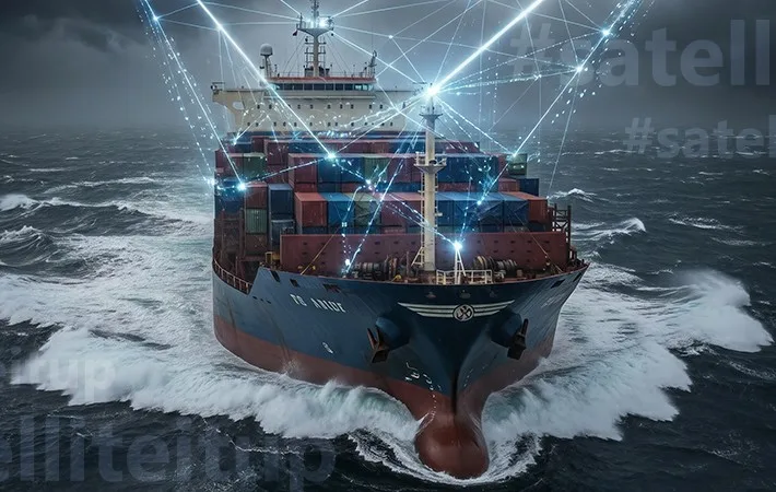
In Indonesia, a vessel can move from full connectivity to complete isolation within a matter of hours. Major ports such as Jakarta and Surabaya benefit from strong network coverage, but vast stretches of Indonesian waters remain digitally disconnected. This makes it hard for fleet managers and vessel operators to see what is happening on their ships in real time. Without clear information, it is difficult to make fast decisions or keep everyone in touch.
As the world’s largest archipelago, Indonesia depends heavily on maritime transport. It is a sector that already contributes approximately 7% to national GDP and is central to the country’s Global Maritime Axis vision, which targets growing that contribution to 15% by 2045. In this context, smart shipping in Indonesia is not just a technological upgrade. It is a necessity. And at its core lies one critical enabler: resilient, always-on connectivity.
The Cost of a Disconnected Fleet
When connectivity fails, fleet operations break down. For many Indonesian fleets, from domestic cargo vessels to offshore support operations in the Makassar Strait and Arafura Sea, the connectivity gap creates risks and costs that multiply quickly.
For operators:
- Vessels burn fuel on sub-optimal routes without real-time weather and current data
- Early signs of engine trouble go undetected, leading to costly unplanned repairs
- Shore teams lose vessel visibility, forcing decisions based on outdated information
- Port coordination reverts to manual communication, causing delays and idle time
For crew:
- No reliable means of contacting family ashore during extended voyages
- Limited access to telemedicine or digital services in remote locations
- Delayed emergency response when incidents occur far from shore
For operators whose margins depend on fuel efficiency and on-time performance, a connectivity failure at the wrong moment carries a direct financial cost. For the crew living with it daily, the impact is just as real.
The Limitations of Single Network Architectures in Modern Shipping
Most Indonesian fleet operators rely on a single connectivity layer. GEO satellite offshore, cellular nearshore. These models worked within their limits. But in today’s data-heavy maritime environment, relying on a single network is no longer a viable business strategy. This is the primary hurdle to achieving smart shipping.
Where single-network models fall short:
- GEO-only – high latency, prone to congestion, no redundancy across diverse route conditions
- Cellular – coverage ends at the shoreline, leaving vessels exposed on any offshore or remote passage
- Neither provides the failover that a vessel needs when operating thousands of nautical miles from port
When a single network goes down, the operational impact is immediate:
- Shore teams lose real-time vessel tracking
- Engine telemetry stops transmitting
- Weather routing goes dark
- Port coordination reverts to manual, delayed communication
Establishing the Framework for Smart Shipping
As operations in Indonesia become more cloud-dependent and regulated, the industry is shifting away from simple bandwidth purchases toward integrated hybrid architectures.
This approach, combining satellites across multiple orbits with terrestrial networks, is fast becoming the foundation of a smart shipping ecosystem. It is not about replacing legacy connectivity systems, but about layering them to ensure that performance never collapses when a vessel moves beyond the reach of land. By intelligently combining multiple networks (satellite and cellular), operators can transform fragmented setups into a managed framework that keeps the fleet smart, visible, and connected at all times.
Managed Hybrid Networks: Enabling Continuity Across Indonesia’s Maritime Corridors
Indonesia’s maritime environment demands a connectivity architecture designed for dispersion, not density. A single network cannot cover the range of conditions a vessel encounters, such as nearshore coastal waters, open ocean, remote inter-island passages, and offshore energy corridors. A layered approach does.
Managed hybrid connectivity combines multi-orbit connectivity (LEO, GEO) with LTE and L-band into a single intelligent framework, with each layer serving a distinct purpose.
1. LEO | High-Throughput Performance at Sea
With satellites significantly closer to Earth, LEO connectivity provides high-speed, low-latency broadband that supports the data-intensive applications modern fleet operations depend on, such as real-time telemetry, engine monitoring, video communication, and seamless integration with shore-based management systems.
With Starlink’s industry-leading LEO coverage spanning Indonesia’s maritime map, vessels can maintain high-throughput data exchanges on both domestic and regional voyages. As an authorised Starlink reseller with over three decades of satellite expertise, IEC Telecom goes beyond hardware supply. We integrate Starlink into a fully managed maritime ecosystem, backed by local support, hybrid network configuration, and end-to-end service management. For Indonesian fleet operators, our Starlink Maritime Portfolio represents a practical step-change:
- Download speeds up to 475 Mbps with 20-60ms latency
- Crew welfare portal with self-service data vouchers and pay-as-you-go options
- Automatic failover and backup for uninterrupted business continuity
- Full fleet usage, traffic, and link monitoring in one portal
- 24/7 remote support
LEVEL UP WITH STARLINK MARITIME PORTFOLIO
No matter where your journey takes you, ensure best user experience on board
- Starlink Flat High Performance
- Resilient back-up options
- Advanced network management
- Voucher system for crew welfare
- Cyber-security services
- Global logistics, 24/7 support and more
2. GEO | Stability Across Wide-Area Routes
Geostationary satellites hold a fixed position relative to Earth, providing a stable, continuous data link across broad coverage areas. For large cargo vessels and offshore support fleets operating across Indonesia’s dispersed routes, GEO handles day-to-day operational functions, like administrative systems, routine data transfers, and fleet management workflows, where consistent, predictable connectivity matters more than speed.
Because GEO satellites maintain a fixed look angle, signal stability across Indonesia’s sea lanes remains steady, making it a reliable connectivity layer between high-throughput LEO and safety-critical L-band during periods of LEO congestion or variability.
3. LTE | Efficient Nearshore Connectivity
LTE handles cost-efficient connectivity when vessels are within coastal range, such as during port approach, berth operations, and short inter-island passages near major population centres. For domestic fleet operators running high-frequency routes between Java, Sumatra, and Bali, LTE provides a practical and economical connectivity layer that reduces dependence on satellite bandwidth in areas where terrestrial coverage is adequate.
4. L-Band | The Safety and Compliance Layer
L-band provides the safety net in a multinetwork architecture. Highly resistant to atmospheric interference and independently powered, L-band remains the gold standard for distress communication, emergency signalling, and GMDSS compliance. For vessels operating in Indonesia’s more remote sea areas, L-band is the layer that holds when everything else is under pressure.
Managed Connectivity: Where Architecture Becomes Intelligence
Hardware alone does not deliver resilience. What makes this hybrid architecture genuinely effective is the intelligence above the network layers, and that is where our network management platform, OptiView, comes in. OptiView transforms connectivity from passive infrastructure into an actively managed operational asset:
- Full fleet visibility – all active links, traffic, and consumption in one view
- Intelligent traffic routing – applications directed to the right network automatically
- Automatic failover – seamless switching between LEO, GEO, and LTE
- Bandwidth prioritisation – critical systems are always served first
- Usage and credit management – bandwidth allocated where it matters
- Detailed reporting – real-time analytics for proactive network decisions
EXPLORE OPTIVIEW
Ultimate gateway to network management
- Performance & Usage Insights
- Voucher Monitoring
- Credit Limit Management
- Advanced Filtration
- Value-Added Services
Driving Operational Efficiency through Managed Connectivity
Reliable hybrid connectivity is not just an infrastructure decision for smart shipping. It directly shapes how efficiently a fleet operates day to day.
Fuel and Route Efficiency: Data-driven routing, incorporating real-time weather, currents, and vessel performance, allows Indonesian fleet operators to optimise continuously across the entire voyage, not just near port. For routes spanning thousands of nautical miles, the fuel savings are material.
Predictive Maintenance: Continuous engine telemetry allows shore engineers to catch anomalies before they become failures. In eastern Indonesia, far from major repair facilities, an unplanned port call carries a significantly higher cost than scheduled maintenance. For offshore operators, the same connectivity also supports automated emissions and regulatory reporting.
Crew Welfare and Retention: Managed connectivity is a strategic tool for talent retention. With a shortfall of 90,000 seafarers projected for 2026, high-speed access is now a recruitment necessity.
With a fully managed hybrid architecture, along with our award-winning crew welfare framework, IEC Voucher Management System, we enable operators to provide reliable and fairly distributed connectivity to their crew. This supports better mental well-being, helps reduce turnover, and strengthens the human talent needed to support the growth of smart shipping in Indonesia. IEC Voucher Management System provides:
- Centralised dashboard for managing crew data allowances
- Crew self-service portal for real-time usage tracking and top-ups
- Flexible access policies, configurable by duration, volume, or user category
- Scalable across multiple vessels with 24/7 support
IEC VOUCHER MANAGEMENT SYSTEM
- Centralised governance through a unified management portal
- Real-time visibility of allocation and usage
- Streamlined voucher creation and monitoring
- Captive portal for on-demand data access
- Designed for scalable, multi-user environments
Cybersecurity and IMO Compliance
As Indonesian fleets become more data-dependent, the integrity of the systems carrying that data becomes as operationally important as the data itself. Cybersecurity is not a separate workstream. It is part of what makes a smart vessel genuinely safe to operate.
Without proper cybersecurity, connected vessels are exposed to:
- Unsecured onboard networks are exploited remotely to disrupt navigation or cargo systems
- Malware introduced through crew devices or third-party software updates
- Data breaches exposing commercially sensitive operational and routing information
- IMO cybersecurity non-compliance creating regulatory exposure during port state inspections
To address these risks, our value-added cybersecurity service, OptiShield, functions as the security gateway for the entire connectivity layer. When deployed alongside OptiView, OptiShield enables an actively monitored, compliance-ready operation.
What OptiShield by IEC Telecom delivers in this environment:
- 24/7 cyber response – dedicated expert team, real-time threat intelligence, always on
- Automated threat containment – incidents resolved without crew intervention
- Full network visibility – all onboard endpoints monitored through a single dashboard
- IMO compliance support – security reports, incident notifications, and usage analytics on demand
NAVIGATE SAFELY WITH OPTISHIELD
- Dedicated 24/7 cyber response team
- Advanced threat detection & protection
- Centralised management of end-points security
- Compliance management
The Future of Smart Shipping in Indonesia
Indonesia’s maritime transformation depends on more than just physical routes; it requires a digital backbone. Managed hybrid connectivity is the essential bridge that turns isolated vessels into high-performance assets. By combining resilient satellite layers with our cybersecurity and network management capabilities, we at IEC Telecom help operators reduce costs, ensure regulatory compliance, and protect their data.
As Indonesia moves toward its national logistics goals, our managed approach provides the security and visibility needed to build a competitive, future-ready smart shipping ecosystem.


Build the Right Connectivity Solution
Tell us where you operate and what you need to connect. Our experts will help identify the right solution for your operations.